


How do we explore them, and respond to what triggers? What we know or do not know depends on the means used (how we look) and on the questions we ask ourselves (what we look at or search for). These questions point to the exploratory mission of science that its current bureaucracy tends to forget.
[Article issu de The Conversation, écrit par Collot Julien, enseignant chercheur en géosciences marines, Université de Bretagne occidentale, David Baratoux, geologist, Institut de recherche pour le développement (IRD), Pierre-Yves Le MeurAnthropologist, Senior Researcher, Institut de recherche pour le développement (IRD), Sarah Samadi professeur en biologie évolutive, Muséum national d’histoire naturelle (MNHN)]
Oceans cover 70% of the Earth, and their average depth is 3,700 metres. Look with the mask from the surface, you will not see the bottom unless there is less than 10 meters of water. Look at the sky, the photons that reach you could have been millions of light years away! Water is the main obstacle to knowing the sea floor: electromagnetic waves (light, lasers, radio waves) are absorbed very quickly there, while propagating over huge distances in space.
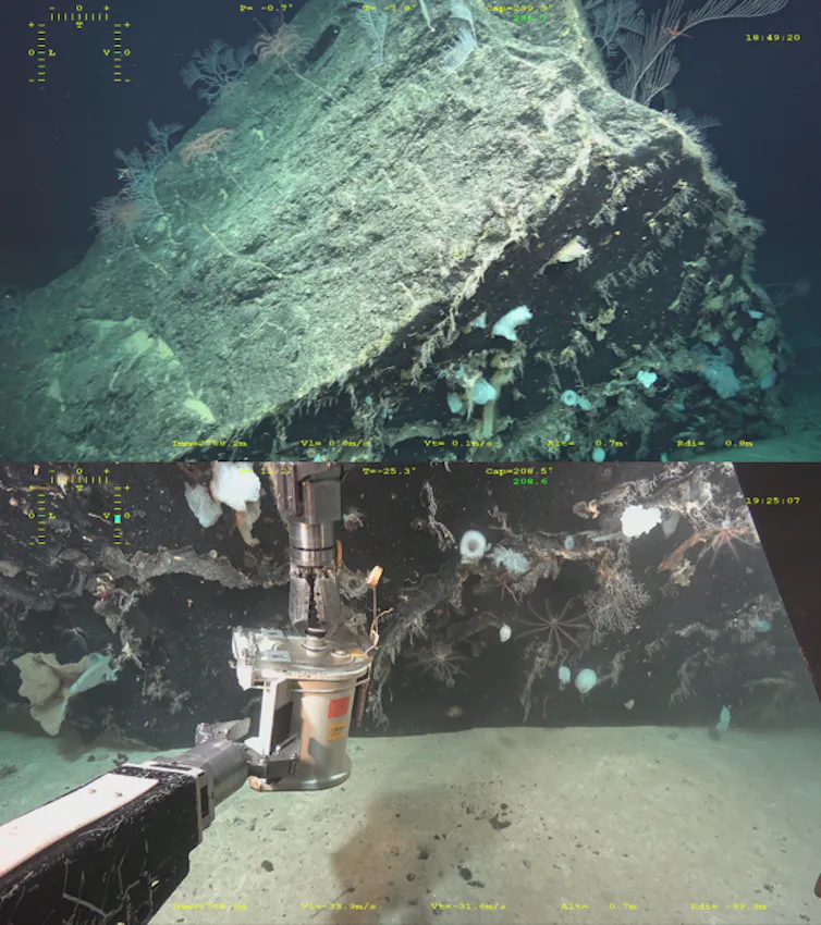
Therefore, we can only characterize the oceans indirectly from ships, using acoustic instruments or by taking samples obtained with instruments suspended from a cable. Sometimes we use manned or robotic submarines that can only observe from ten meters around with powerful projectors. In 2023 only 25% of sea floor engravings It was mapped by acoustic methods.
This type of ship that allows mapping moves at only 5 km/h, so it would take three centuries to cover the entire sea floor at that rate. In the 1990s, a new method made it possible to roughly estimate ocean depth from small differences in the height of the water surface, measured by satellites (altimetry). These are the maps we consult in Google Earth.
Everywhere we look, we discover indigenous organisms. Deep sea exploration It reveals, for example, living animals whose closest relatives are fossil animals – and then extinct – known for a long time in the sedimentary layers of the continents! It was also discovered at the end of the 1970s that the process of photosynthesis is not only the primary source of living matter. Thus, at the foot of deep hydrothermal vents, emitting hot and “toxic” fluids, oases of life multiply thanks to chemosynthetic bacteria capable of producing organic matter without light. Since then, the chemical composition has been observed also in coastal environments but also on land and even in the atmosphere!
Space discovery
Regarding space, the sending of the Soviet Luna 1 probe in 1959 marked the beginning of space exploration of the solar system. 60 years later, all eight planets in the solar system have been visited by space probes, as well as the giant planets' largest satellites. These probes have produced images of extraterrestrial landscapes that are uninhabitable, but incredibly diverse.
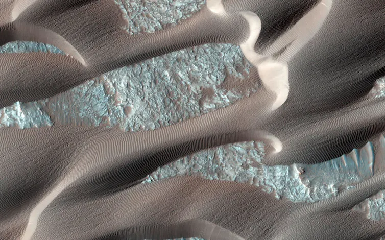
Exploration using space cameras has been rapidly enriched with tools that make it possible to map the nature of materials (chemical composition, mineralogy, search for organic molecules) while in situ exploration develops (landing, then vehicles capable of rolling, and very recently) a small helicopter), for more Movement to explore. It is possible to produce geological maps of any red planet without any human having set foot on its soil.
Our knowledge of the solar system also comes from impact-ridden meteorites that end their interplanetary journey on the surface of our planet. Space missions are also dedicated to collecting samples. This was the case for the Apollo missions to the Moon, and more recently for the OSIRIS-REx mission that was able to return a sample of the asteroid Bennu to Earth. Soon, it will be Mars' turn.
Space sensors have reached great distances. After flying over the planet Pluto, the New Horizons probe headed to the borders of the solar system (more than 6 billion kilometers from Earth) to provide images of a small snowman-shaped asteroid (Arrokoth) that tells us about the first moments of the planet’s formation. But there is still a lot to explore, in search of habitable environments. Thousands of objects in the solar system (asteroids and small satellites of giant planets) can only be recognized by the light they reflect from the Sun. The distances traveled indeed seem enormous, but no man-made space probe has ever left the Sun's zone of influence, even if Voyager 1 and 2 were already on their way to the interstellar medium. To reach the star closest to us, we must travel not a few billion kilometers, but 40 thousand billion! We can currently only directly explore space outside the solar system through the light sent to us by the beings inhabiting the universe.
At the cartographic level, it is true to say that we know the surface of the stars of the solar system better than the bottom of the sea. The resources allocated to the former are greater (2 billion euros went to space exploration in France in 2020, compared to 0.4 billion for the ocean floor). Beyond the solar system, technological prowess makes it possible to see some details on the “surface” of stars, revealing the rocky or gaseous nature of exoplanets, but we are a long way from mapping the hundreds of billions of objects that inhabit our planet. galaxy.
It must be emphasized again here that science is largely a matter of exploration and that it is necessary to develop this fundamental dimension. This exploration is closely linked to the search for the origins of life, even if there are other issues, economic or geopolitical, that also motivate this search. Organic molecules discovered outside our planet or biological and geological processes identified in the dark environments of the seafloor call into question the ability of life to evolve anywhere else and everywhere in the universe. Space exploration and the seabed are not mutually exclusive, they are complementary, feeding into each other to understand our origins, rethink our present and design our future!

“Music guru. Incurable web practitioner. Thinker. Lifelong zombie junkie. Tv buff. Typical organizer. Evil beer scholar.”
More Stories
The new relaxation area Bonjour Québec is now open in Dégelis
Seven contributions of artificial intelligence to the advancement of nuclear science and technology
A Manitoba university wants to create a space for reconciliation on its campus